


1,084 metres above Lysefjord
Kjerag & Kjeragbolten, Norway
A demanding mountain day above Lysefjord, with three steep climbs, open granite terrain and the famous Kjeragbolten near the end of the route.
See Our Tours Book Now
A proper mountain hike
11 kilometres and three hard climbs
Kjerag is more demanding than Preikestolen. Expect around 800 metres of elevation gain, exposed rock, chains on steep sections and weather that can change quickly.
See the hike Book Now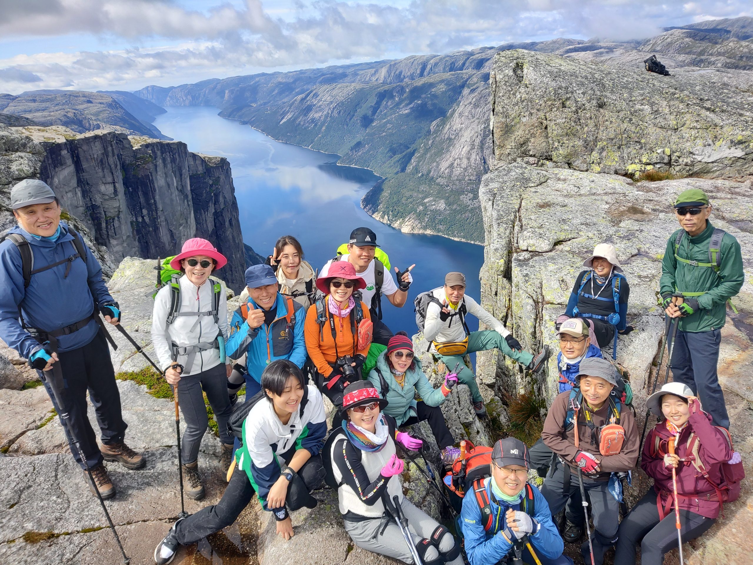
The boulder is only part of it
Kjerag is a full mountain day
The route, the high plateau and the views over Lysefjord matter as much as the photograph on Kjeragbolten. Give the mountain the time it deserves.
Plan the day Book Now

The boulder gets the photograph. The mountain earns it.
Kjerag rises to 1,084 metres above Lysefjord and is the highest of the classic Lysefjord hiking landmarks. Kjeragbolten is the famous finish, but the route is the real story: three demanding climbs, broad granite plateaus, mountain lakes and long views over Lysebotn and the fjord.
The standard hike is around 11 km return with roughly 800 metres of elevation gain. Allow 6–10 hours for the hike itself. From Stavanger, this is a full-day mountain trip rather than a short excursion.
Kjerag at a glance
Built by first responders. Guided by first responders.
John and Gert Olsson founded TrollAdventure. Our guides come exclusively from first-responder backgrounds — including firefighters, police officers and medics. On Kjerag, that experience matters in practical ways: pacing the three climbs, reading changing weather, judging slippery granite and making calm decisions when conditions change.
Want transport, timing and the mountain day handled for you? See our guided Kjerag hike from Stavanger.
How the Kjerag hike develops
Kjerag is not one steady climb. The route crosses three major ridges with descents between them, which is why the day feels harder than the total distance suggests.
This is a simplified route description, not a GPS elevation chart. For official hiking information and current conditions, see Visit Norway’s Kjerag guide.
What the route is actually like
The hike starts at Øygardstøl above Lysebotn. From the beginning, Kjerag feels different from Preikestolen. The route climbs steep granite slabs, drops again, then repeats the work over three ridges before reaching the high plateau.
Chains and fixed wires help on the steepest sections. In dry conditions they are useful; in rain, smooth granite becomes much more serious. The route is marked, but fitness, footwear and weather judgement matter throughout the day.
The final kilometres across the plateau are less steep, but this is where wind and exposure can become more noticeable. Kjeragbolten sits near the end of the route, above the inner Lysefjord.
What to bring
- Proper hiking shoes with strong grip
- Wind- and rain-resistant shell
- Warm layer, even in summer
- Enough food and water for a long day
- Small backpack
- Sun protection and cap
- Headlamp when daylight is limited
Why Kjerag is worth the work
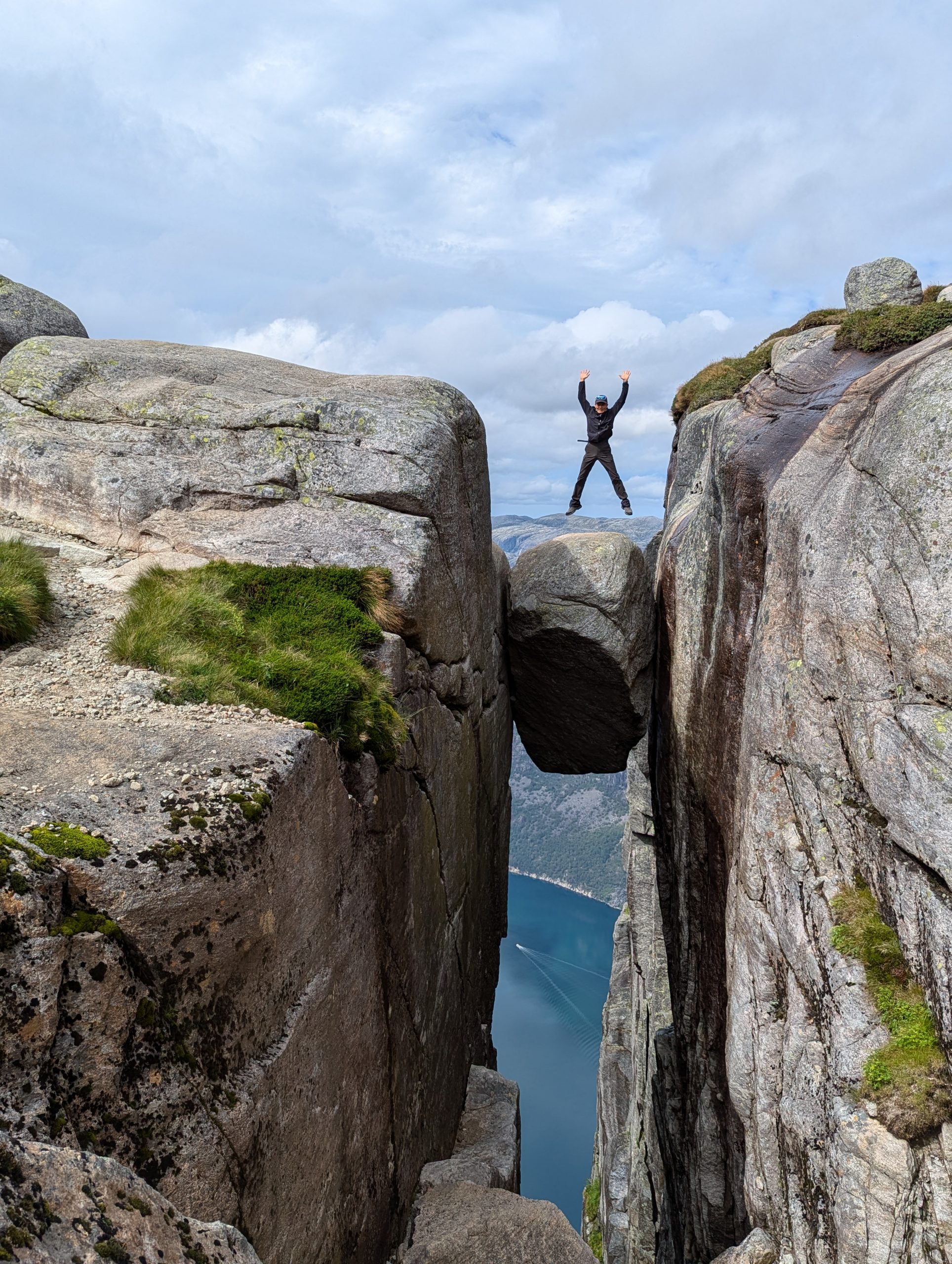
Kjeragbolten
The glacial boulder wedged between two rock faces is the famous image. Stepping onto it is optional. The mountain does not become a lesser experience if you decide not to.
Lysefjord from 1,000 metres
The scale is different from Preikestolen. From Kjerag, the inner fjord and Lysebotn sit far below, with long views through the mountain landscape.
Three real climbs
The repeated ascents and descents give Kjerag its character. It is a physically honest hike and feels earned by the time you reach the plateau.
The high plateau
Beyond the steep ridges, the terrain opens into a broad, exposed mountain landscape. Weather can move across it quickly, which is part of why timing matters.
Kjerag is more than the boulder
Kjerag cliffs high above Lysefjord Hiker on Kjeragbolten
 Changing mountain weather on Kjerag
 Small group on the Kjerag trail
 Lysefjord from the Kjerag mountain
 Kjeragbolten above Lysefjord
 Mountain terrain on the route to Kjerag
 Hikers crossing open granite
 Cliff views above the fjord
 TrollAdventure group on Kjerag
From Stavanger to Øygardstøl
The usual road route from Stavanger runs south through Ålgård and into Sirdal before crossing the mountain road toward Lysebotn. Allow roughly 2.5 hours each way in normal summer conditions.
The trail begins at Øygardstøl, above Lysebotn. The mountain road is seasonal and closes when snow and ice make it unsafe, so access is very different from Preikestolen.
Build the whole day around the mountain
The hike alone can take 6–10 hours. Add the drive from Stavanger, stops and time at Kjeragbolten, and this is normally a 10–12 hour guided day.
When should you hike Kjerag?
Mid-May to September
This is the normal hiking season, depending on snow conditions and when the road to Øygardstøl opens. Early season can still have significant snow on the plateau.
Summer
Long daylight makes the full day easier to manage. Even in midsummer, expect wind and fast weather changes at more than 1,000 metres above sea level.
Rain changes the route
Smooth granite and steep slabs become much more slippery when wet. Kjerag is one of those hikes where the same route can feel completely different from one day to the next.
Winter
The road to the trailhead is normally closed through winter, and the standard hiking route is not a normal winter visitor hike.
On Kjerag, judgement matters as much as fitness
Want the mountain day without the logistics?
Guided Kjerag hike from Stavanger
We handle transport from Stavanger, timing, trailhead logistics and the practical decisions around the hike. The tour is private for small groups and normally runs as a 10–12 hour day.
Which of our Top 5 Hikes fits your day?
Kjerag sits firmly at the demanding end of the Lysefjord day hikes. It requires more fitness and time than Pulpit Rock, while Trolltunga is longer again. Flørli is different: steep, repetitive and defined by its 4,444 wooden steps. See the wider overview on our Top 5 Hikes page.
| Hike | Difficulty | Duration | Good fit for | Tour |
|---|---|---|---|---|
| Pulpit Rock / Preikestolen | Moderate | About 4 h hiking | Active travellers wanting a manageable Lysefjord hike | See tour |
| Kjerag | Demanding | 6–10 h hiking / 10–12 h tour | Fit hikers comfortable with steep climbs and exposed terrain | See tour |
| Trolltunga | Very demanding | Full-day hike | Experienced, fit hikers prepared for a long mountain day | See 4 Top Hikes tour |
| Flørli 4444 | Demanding | 10–12 h tour | Active travellers comfortable with a long, steep staircase | See tour |
| Månafossen | Short but steep | Short hike; longer if continuing to Mån | Travellers wanting a compact waterfall hike and a flexible Frafjord day | See hike |
Want to hike Kjerag with TrollAdventure?
Transport from Stavanger, local guidance and a day planned around the actual mountain conditions.
Questions people ask before hiking Kjerag
How long is the Kjerag hike?
The standard route is around 11 km return and typically takes 6–10 hours, depending on fitness, conditions and time spent near Kjeragbolten.
How difficult is Kjerag?
Kjerag is a demanding mountain hike with roughly 800 metres of elevation gain, three major climbs and steep granite sections where chains or wires are used for assistance.
How far is Kjerag from Stavanger?
Allow roughly 2.5 hours by car from Stavanger to Øygardstøl in normal summer conditions.
Can I hike Kjerag without a guide?
Yes, experienced and well-prepared hikers do. A guide is useful if you want transport handled, local knowledge, help with pacing or support when weather and surface conditions are uncertain.
Do I have to stand on Kjeragbolten?
No. Stepping onto the boulder is completely optional. You can visit Kjerag and enjoy the mountain and fjord views without standing on it.
Can Kjerag be hiked in winter?
The standard route is not normally accessible in winter because the mountain road to Øygardstøl closes due to snow and ice.
A full mountain day.
See Kjerag with people who know the route
Start in Stavanger. We handle the road, the logistics and guide the day around the conditions on the mountain.